
Pohlern topographic map
Interactive map
Click on the map to display elevation.
About this map
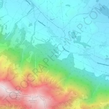
Name: Pohlern topographic map, elevation, terrain.
Average elevation: 1,006 m
Minimum elevation: 638 m
Maximum elevation: 1,950 m
Other topographic maps
Click on a map to view its topography, its elevation and its terrain.
Wattenwil
Suisse > Berne > Arrondissement administratif de Thoune
Wattenwil, Arrondissement administratif de Thoune, Région administrative de l'Oberland, Berne, 3665, Suisse
Average elevation: 780 m
Seftigen
Suisse > Berne > Arrondissement administratif de Thoune
Seftigen, Arrondissement administratif de Thoune, Région administrative de l'Oberland, Berne, 3662, Suisse
Average elevation: 597 m