
Hillerse topographic map
Interactive map
Click on the map to display elevation.
About this map
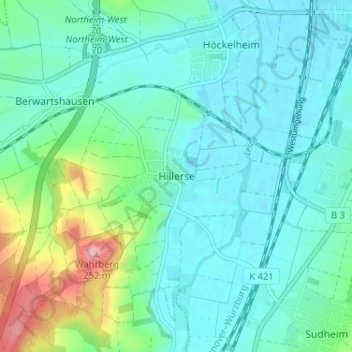
Name: Hillerse topographic map, elevation, terrain.
Average elevation: 142 m
Minimum elevation: 114 m
Maximum elevation: 250 m
Other topographic maps
Click on a map to view its topography, its elevation and its terrain.
Sudheim
Deutschland > Niedersachsen > Landkreis Northeim > Northeim
Sudheim, Northeim, Landkreis Northeim, Niedersachsen, 37154, Deutschland
Average elevation: 176 m
Steinkuhle
Deutschland > Niedersachsen > Landkreis Northeim > Northeim
Steinkuhle, Northeim, Landkreis Northeim, Niedersachsen, Deutschland
Average elevation: 139 m