
Thank you for supporting this site ❤️
Make a donation
Make a donation
Phelps City topographic map
Click on the map to display elevation.
Thank you for supporting this site ❤️
Make a donation
Make a donation
About this map
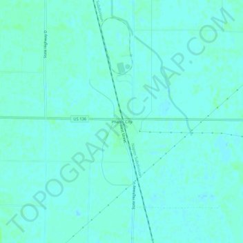
Name: Phelps City topographic map, elevation, terrain.
Location: Phelps City, Atchison County, Missouri, United States (40.38333 -95.61860 40.42333 -95.57860)
Average elevation: 272 m
Minimum elevation: 269 m
Maximum elevation: 276 m
Thank you for supporting this site ❤️
Make a donation
Make a donation
Other topographic maps
Click on a map to view its topography, its elevation and its terrain.