
Thank you for supporting this site ❤️
Make a donation
Make a donation
Deer Island topographic map
Click on the map to display elevation.
Thank you for supporting this site ❤️
Make a donation
Make a donation
About this map
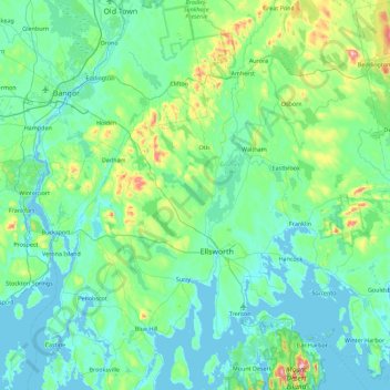
Name: Deer Island topographic map, elevation, terrain.
Location: Deer Island, Ellsworth, Hancock County, Maine, United States (44.31230 -68.79308 44.95230 -68.15308)
Average elevation: 64 m
Minimum elevation: -4 m
Maximum elevation: 461 m
Thank you for supporting this site ❤️
Make a donation
Make a donation