
Ogooué-Maritime topographic map
Interactive map
Click on the map to display elevation.
About this map
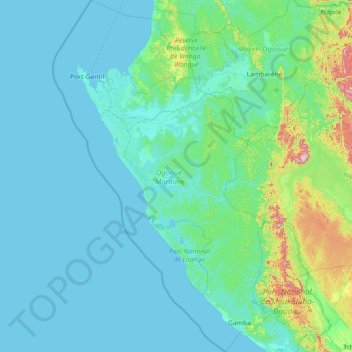
Name: Ogooué-Maritime topographic map, elevation, terrain.
Location: Ogooué-Maritime, Gabon (-2.96043 8.50022 -0.09464 10.59070)
Average elevation: 53 m
Minimum elevation: -1 m
Maximum elevation: 857 m
Other topographic maps
Click on a map to view its topography, its elevation and its terrain.