
Thank you for supporting this site ❤️
Make a donation
Make a donation
Woodbine topographic map
Click on the map to display elevation.
Thank you for supporting this site ❤️
Make a donation
Make a donation
About this map
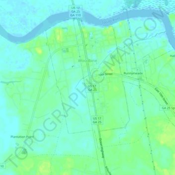
Name: Woodbine topographic map, elevation, terrain.
Location: Woodbine, Camden County, Georgia, United States (30.94083 -81.73435 30.97384 -81.68541)
Average elevation: 6 m
Minimum elevation: -4 m
Maximum elevation: 14 m
Thank you for supporting this site ❤️
Make a donation
Make a donation
Other topographic maps
Click on a map to view its topography, its elevation and its terrain.