
Thank you for supporting this site ❤️
Make a donation
Make a donation
Powder King Peak topographic map
Click on the map to display elevation.
Thank you for supporting this site ❤️
Make a donation
Make a donation
About this map
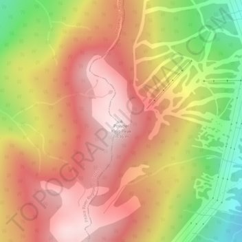
Name: Powder King Peak topographic map, elevation, terrain.
Average elevation: 1,381 m
Minimum elevation: 1,004 m
Maximum elevation: 1,642 m
Thank you for supporting this site ❤️
Make a donation
Make a donation
Other topographic maps
Click on a map to view its topography, its elevation and its terrain.
Crooked River Provincial Park
Canada > British Columbia > Regional District of Fraser-Fort George > Area G (Crooked River/Parsnip) > Bear Lake
Average elevation: 716 m