
Thank you for supporting this site ❤️
Make a donation
Make a donation
Monte Celo topographic map
Click on the map to display elevation.
Thank you for supporting this site ❤️
Make a donation
Make a donation
About this map
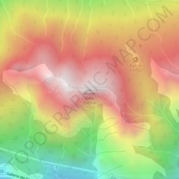
Name: Monte Celo topographic map, elevation, terrain.
Location: Monte Celo, La Valle Agordina, Belluno, Veneto, 32020, Italia (46.26331 12.09245 46.26341 12.09255)
Average elevation: 1,383 m
Minimum elevation: 543 m
Maximum elevation: 2,044 m
Thank you for supporting this site ❤️
Make a donation
Make a donation