
Houthulst topographic map
Interactive map
Click on the map to display elevation.
About this map
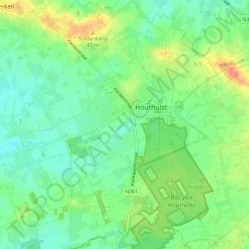
Name: Houthulst topographic map, elevation, terrain.
Location: Houthulst, Diksmuide, Westflandern, Flandern, Belgien (50.94871 2.92191 50.99914 2.97372)
Average elevation: 19 m
Minimum elevation: 4 m
Maximum elevation: 46 m