Auf den Anweiler Weg topographic map
Interactive map
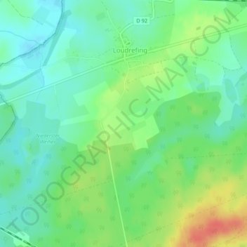
Click on the map to display elevation.
About this map
Name: Auf den Anweiler Weg topographic map, elevation, terrain.
Average elevation: 244 m
Minimum elevation: 226 m
Maximum elevation: 277 m

Click on the map to display elevation.
Name: Auf den Anweiler Weg topographic map, elevation, terrain.
Average elevation: 244 m
Minimum elevation: 226 m
Maximum elevation: 277 m