
Thank you for supporting this site ❤️
Make a donation
Make a donation
Sativanorte topographic map
Click on the map to display elevation.
Thank you for supporting this site ❤️
Make a donation
Make a donation
About this map
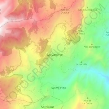
Name: Sativanorte topographic map, elevation, terrain.
Location: Sativanorte, Norte, Boyacá, RAP (Especial) Central, Colombia (6.09192 -72.74760 6.17192 -72.66760)
Average elevation: 2,811 m
Minimum elevation: 1,894 m
Maximum elevation: 3,872 m
Thank you for supporting this site ❤️
Make a donation
Make a donation