
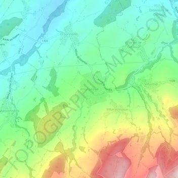
Villargiroud topographic map
Interactive map
Click on the map to display elevation.
About this map
Name: Villargiroud topographic map, elevation, terrain.
Average elevation: 800 m
Minimum elevation: 649 m
Maximum elevation: 1,089 m
Other topographic maps
Click on a map to view its topography, its elevation and its terrain.
Villarsiviriaux
Suisse > Fribourg > District de la Glâne > Villorsonnens
Villarsiviriaux, Villorsonnens, District de la Glâne, Fribourg, 1694, Suisse
Average elevation: 859 m