
Supa topographic map
Click on the map to display elevation.
About this map
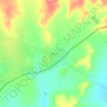
Name: Supa topographic map, elevation, terrain.
Location: Supa, Parner, Maharashtra, 414300, India (18.93974 74.51419 18.97974 74.55419)
Average elevation: 720 m
Minimum elevation: 681 m
Maximum elevation: 776 m
Other topographic maps
Click on a map to view its topography, its elevation and its terrain.