
Thank you for supporting this site ❤️
Make a donation
Make a donation
Temal topographic map
Click on the map to display elevation.
Thank you for supporting this site ❤️
Make a donation
Make a donation
About this map
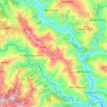
Name: Temal topographic map, elevation, terrain.
Location: Temal, Kavrepalanchok, Bagmati Province, Nepal (27.43819 85.69137 27.58458 85.82091)
Average elevation: 1,176 m
Minimum elevation: 523 m
Maximum elevation: 2,280 m
Thank you for supporting this site ❤️
Make a donation
Make a donation
Other topographic maps
Click on a map to view its topography, its elevation and its terrain.