
Thank you for supporting this site ❤️
Make a donation
Make a donation
Oestrich-Winkel topographic map
Click on the map to display elevation.
Thank you for supporting this site ❤️
Make a donation
Make a donation
About this map
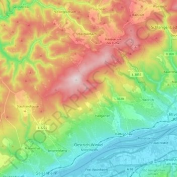
Name: Oestrich-Winkel topographic map, elevation, terrain.
Location: Oestrich-Winkel, Rheingau-Taunus-Kreis, Hesse, 65375, Germany (49.98342 7.91156 50.11297 8.05466)
Average elevation: 299 m
Minimum elevation: 78 m
Maximum elevation: 626 m
Thank you for supporting this site ❤️
Make a donation
Make a donation
Other topographic maps
Click on a map to view its topography, its elevation and its terrain.
Wehener Wand und Rentmauer Wiesbaden
Germany > Hesse > Rheingau-Taunus-Kreis > Wiesbaden
Average elevation: 377 m
Thank you for supporting this site ❤️
Make a donation
Make a donation
Teufelskadrich bei Lorch
Germany > Hesse > Rheingau-Taunus-Kreis > Rüdesheim am Rhein > Assmannshausen
Average elevation: 253 m