
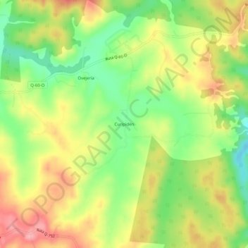
Curipidén topographic map
Interactive map
Click on the map to display elevation.
About this map
Name: Curipidén topographic map, elevation, terrain.
Average elevation: 192 m
Minimum elevation: 130 m
Maximum elevation: 256 m
Other topographic maps
Click on a map to view its topography, its elevation and its terrain.
Monterrey Alto
Chile > Región del Biobío > Provincia de Bío-Bío > Yumbel
Monterrey Alto, Yumbel, Provincia de Bío-Bío, Región del Biobío, Chile
Average elevation: 204 m
Cambrales
Chile > Región del Biobío > Provincia de Bío-Bío > Yumbel
Cambrales, Yumbel, Provincia de Bío-Bío, Región del Biobío, Chile
Average elevation: 111 m
Rere
Chile > Región del Biobío > Provincia de Bío-Bío > Yumbel
Rere, Yumbel, Provincia de Bío-Bío, Región del Biobío, Chile
Average elevation: 174 m