
Thank you for supporting this site ❤️
Make a donation
Make a donation
Penley topographic map
Click on the map to display elevation.
Thank you for supporting this site ❤️
Make a donation
Make a donation
About this map
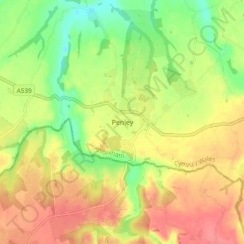
Name: Penley topographic map, elevation, terrain.
Location: Penley, Wrexham, Wales, LL13 0LQ, United Kingdom (52.93188 -2.89287 52.97188 -2.85287)
Average elevation: 66 m
Minimum elevation: 29 m
Maximum elevation: 98 m
Thank you for supporting this site ❤️
Make a donation
Make a donation
Other topographic maps
Click on a map to view its topography, its elevation and its terrain.