
Oppenheim topographic map
Interactive map
Click on the map to display elevation.
About this map
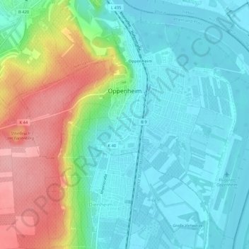
Name: Oppenheim topographic map, elevation, terrain.
Average elevation: 121 m
Minimum elevation: 82 m
Maximum elevation: 212 m
Other topographic maps
Click on a map to view its topography, its elevation and its terrain.
Niederheimbach
Allemagne > Rhénanie-Palatinat > Landkreis Mainz-Bingen > Niederheimbach
Niederheimbach, Rhein-Nahe, Landkreis Mainz-Bingen, Rhénanie-Palatinat, 55413, Allemagne
Average elevation: 304 m