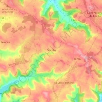
Click on the map to display elevation.
Name: Castella topographic map, elevation, terrain.
Location: Castella, Agen, Lot-et-Garonne, Nouvelle-Aquitaine, Metropolitan France, 47340, France (44.29028 0.64068 44.33462 0.71929)
Average elevation: 190 m
Minimum elevation: 105 m
Maximum elevation: 238 m
Click on a map to view its topography, its elevation and its terrain.
France > Nouvelle-Aquitaine > Lot-et-Garonne > Couthures-sur-Garonne
Average elevation: 21 m
France > Nouvelle-Aquitaine > Lot-et-Garonne > Antagnac
Average elevation: 144 m
France > Nouvelle-Aquitaine > Lot-et-Garonne > Pujols
Average elevation: 102 m
France > Nouvelle-Aquitaine > Lot-et-Garonne > La Réunion
Average elevation: 93 m
Average elevation: 128 m