
Mabonde topographic map
Interactive map
Click on the map to display elevation.
About this map
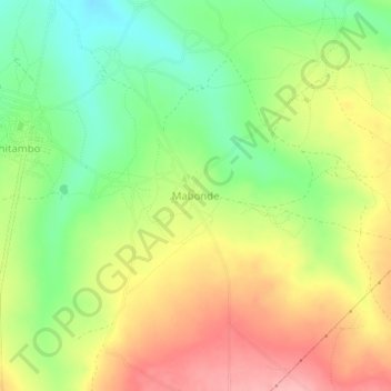
Name: Mabonde topographic map, elevation, terrain.
Location: Mabonde, Chitambo District, Central Province, Zambia (-12.94020 30.63516 -12.90020 30.67516)
Average elevation: 1,511 m
Minimum elevation: 1,452 m
Maximum elevation: 1,575 m
Other topographic maps
Click on a map to view its topography, its elevation and its terrain.
Kabwe
Kabwe, Kabwe District, Central Province, Zambia
Average elevation: 1,187 m