
Plazy topographic map
Interactive map
Click on the map to display elevation.
About this map
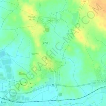
Name: Plazy topographic map, elevation, terrain.
Location: Plazy, okres Mladá Boleslav, Central Bohemia, Czechia (50.40827 14.94857 50.42898 14.98286)
Average elevation: 221 m
Minimum elevation: 210 m
Maximum elevation: 238 m
Other topographic maps
Click on a map to view its topography, its elevation and its terrain.
CHKO Křivoklátsko
Czechia > Central Bohemia > Nezabudice
CHKO Křivoklátsko, 201, Nezabudice, okres Rakovník, Středočeský kraj, Central Bohemia, 27023, Czechia
Average elevation: 400 m
Libiš
Czechia > Central Bohemia > Libiš
Libiš, okres Mělník, Středočeský kraj, Central Bohemia, 27717, Czechia
Average elevation: 168 m