
Thank you for supporting this site ❤️
Make a donation
Make a donation
Santa Clara topographic map
Click on the map to display elevation.
Thank you for supporting this site ❤️
Make a donation
Make a donation
About this map
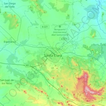
Name: Santa Clara topographic map, elevation, terrain.
Location: Santa Clara, Villa Clara, Cuba (22.26352 -80.08116 22.56228 -79.76393)
Average elevation: 125 m
Minimum elevation: 35 m
Maximum elevation: 457 m
Thank you for supporting this site ❤️
Make a donation
Make a donation