
Thank you for supporting this site ❤️
Make a donation
Make a donation
Charnwood topographic map
Click on the map to display elevation.
Thank you for supporting this site ❤️
Make a donation
Make a donation
About this map
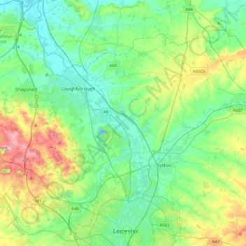
Name: Charnwood topographic map, elevation, terrain.
Location: Charnwood, Leicestershire, England, United Kingdom (52.65385 -1.33507 52.82470 -0.94725)
Average elevation: 92 m
Minimum elevation: 29 m
Maximum elevation: 269 m
Thank you for supporting this site ❤️
Make a donation
Make a donation
Other topographic maps
Click on a map to view its topography, its elevation and its terrain.