
East Glenville topographic map
Interactive map
Click on the map to display elevation.
About this map
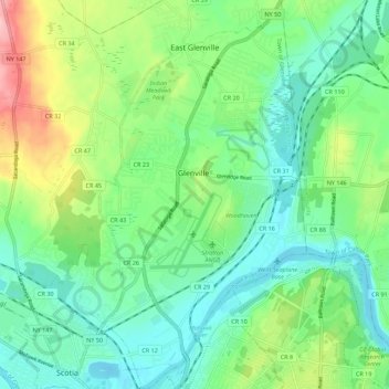
Name: East Glenville topographic map, elevation, terrain.
Average elevation: 105 m
Minimum elevation: 60 m
Maximum elevation: 214 m
Other topographic maps
Click on a map to view its topography, its elevation and its terrain.
Mohawk River
United States > New York > Schenectady County > City of Schenectady > East Glenville
Mohawk River, The Stockade, East Glenville, City of Schenectady, Schenectady County, New York, 12345, United States
Average elevation: 74 m