
Thank you for supporting this site ❤️
Make a donation
Make a donation
Kampung Sg Aping topographic map
Click on the map to display elevation.
Thank you for supporting this site ❤️
Make a donation
Make a donation
About this map
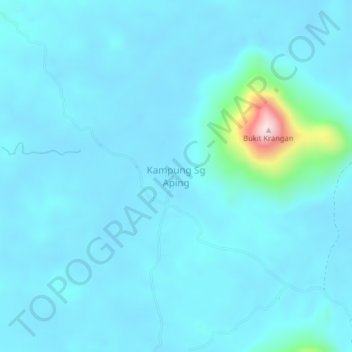
Name: Kampung Sg Aping topographic map, elevation, terrain.
Location: Kampung Sg Aping, Serian, Serian Division, Sarawak, Malaysia (0.94120 110.67039 0.98120 110.71039)
Average elevation: 45 m
Minimum elevation: 11 m
Maximum elevation: 420 m
Thank you for supporting this site ❤️
Make a donation
Make a donation
Other topographic maps
Click on a map to view its topography, its elevation and its terrain.