
La Possession topographic map
Interactive map
Click on the map to display elevation.
About this map
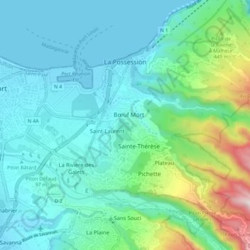
Name: La Possession topographic map, elevation, terrain.
Location: La Possession, Saint-Paul, La Réunion, 9719, France (-20.98713 55.29618 -20.90713 55.37618)
Average elevation: 219 m
Minimum elevation: -1 m
Maximum elevation: 1,127 m