
Thank you for supporting this site ❤️
Make a donation
Make a donation
Monroe County topographic map
Click on the map to display elevation.
Thank you for supporting this site ❤️
Make a donation
Make a donation
About this map
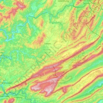
Name: Monroe County topographic map, elevation, terrain.
Location: Monroe County, West Virginia, United States (37.37236 -80.85956 37.73170 -80.22086)
Average elevation: 711 m
Minimum elevation: 427 m
Maximum elevation: 1,313 m
Thank you for supporting this site ❤️
Make a donation
Make a donation
Other topographic maps
Click on a map to view its topography, its elevation and its terrain.