
Thank you for supporting this site ❤️
Make a donation
Make a donation
Bandarjo topographic map
Click on the map to display elevation.
Thank you for supporting this site ❤️
Make a donation
Make a donation
About this map
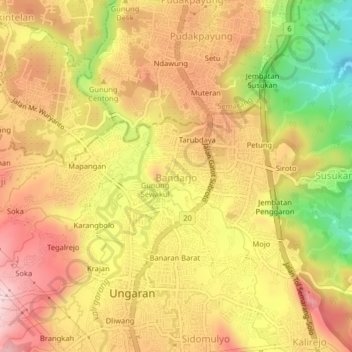
Name: Bandarjo topographic map, elevation, terrain.
Location: Bandarjo, Semarang, Central Java, Java, 50516, Indonesia (-7.13585 110.38893 -7.09585 110.42893)
Average elevation: 312 m
Minimum elevation: 128 m
Maximum elevation: 440 m
Thank you for supporting this site ❤️
Make a donation
Make a donation
Other topographic maps
Click on a map to view its topography, its elevation and its terrain.