
Thank you for supporting this site ❤️
Make a donation
Make a donation
Forty Fort topographic map
Click on the map to display elevation.
Thank you for supporting this site ❤️
Make a donation
Make a donation
About this map
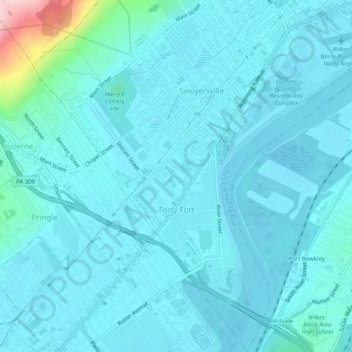
Name: Forty Fort topographic map, elevation, terrain.
Location: Forty Fort, Luzerne County, Pennsylvania, United States (41.26412 -75.88496 41.30143 -75.84889)
Average elevation: 182 m
Minimum elevation: 156 m
Maximum elevation: 415 m
Thank you for supporting this site ❤️
Make a donation
Make a donation
Other topographic maps
Click on a map to view its topography, its elevation and its terrain.