
Thank you for supporting this site ❤️
Make a donation
Make a donation
Le Bettex topographic map
Click on the map to display elevation.
Thank you for supporting this site ❤️
Make a donation
Make a donation
About this map
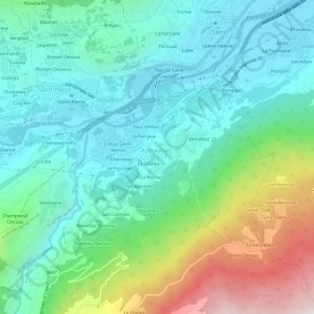
Name: Le Bettex topographic map, elevation, terrain.
Location: Le Bettex, Aymavilles, Valle d'Aosta, 11018, Italia (45.68082 7.22779 45.72082 7.26779)
Average elevation: 955 m
Minimum elevation: 589 m
Maximum elevation: 1,972 m
Thank you for supporting this site ❤️
Make a donation
Make a donation