
Thank you for supporting this site ❤️
Make a donation
Make a donation
Mosquito Lake topographic map
Click on the map to display elevation.
Thank you for supporting this site ❤️
Make a donation
Make a donation
About this map
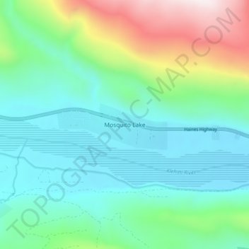
Name: Mosquito Lake topographic map, elevation, terrain.
Location: Mosquito Lake, Haines, Alaska, United States (59.41166 -136.20756 59.45166 -136.16756)
Average elevation: 375 m
Minimum elevation: 111 m
Maximum elevation: 1,168 m
Thank you for supporting this site ❤️
Make a donation
Make a donation
Other topographic maps
Click on a map to view its topography, its elevation and its terrain.