
Thank you for supporting this site ❤️
Make a donation
Make a donation
Binley Woods CP topographic map
Click on the map to display elevation.
Thank you for supporting this site ❤️
Make a donation
Make a donation
About this map
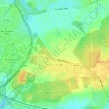
Name: Binley Woods CP topographic map, elevation, terrain.
Location: Binley Woods CP, Rugby, Warwickshire, England, United Kingdom (52.38568 -1.44508 52.40559 -1.40268)
Average elevation: 86 m
Minimum elevation: 71 m
Maximum elevation: 101 m
Thank you for supporting this site ❤️
Make a donation
Make a donation
Other topographic maps
Click on a map to view its topography, its elevation and its terrain.
Thank you for supporting this site ❤️
Make a donation
Make a donation
Brinklow Marina
United Kingdom > England > Warwickshire > Rugby > King's Newnham CP
Average elevation: 95 m
Thank you for supporting this site ❤️
Make a donation
Make a donation