
Make a donation
Stonewall topographic map
Click on the map to display elevation.
Make a donation
Stonewall
When the last ice age retreated, as well as the prairies, escarpments such as Riding Mountain were left behind. In addition to these, smaller elevations were left behind such as Stony Mountain and Stonewall. It is believed that these escarpments were used as look-outs by early hunters approximately 4,000 to 5,000 years ago. These formations were later used as buffalo jumps by the indigenous populations.
Make a donation
About this map
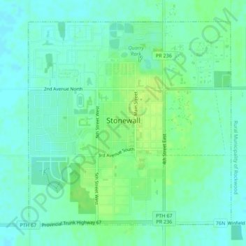
Name: Stonewall topographic map, elevation, terrain.
Location: Stonewall, Division No. 14, Manitoba, R0C 2Z0, Canada (50.12275 -97.34503 50.14507 -97.31026)
Average elevation: 251 m
Minimum elevation: 245 m
Maximum elevation: 259 m
Make a donation
Other topographic maps
Click on a map to view its topography, its elevation and its terrain.
Pinawa
Canada > Manitoba > Division No. 1 > Local Government District of Pinawa
Average elevation: 277 m
Make a donation
Franklin
Canada > Manitoba > Division No. 15 > Rural Municipality of Rosedale
Average elevation: 487 m
Make a donation
Arden
Canada > Manitoba > Division No. 8 > Municipality of Glenella – Lansdowne
Average elevation: 327 m
Turtle Mountain Provincial Park
Canada > Manitoba > Municipality of Boissevain-Morton
Average elevation: 662 m
Make a donation
Oak Bluff
Canada > Manitoba > Division No. 10 > Rural Municipality of Macdonald
Average elevation: 238 m
Silverton
Canada > Manitoba > Division No. 16 > Rural Municipality of Riding Mountain West
Average elevation: 575 m
Sunset Beach
Canada > Manitoba > Division No. 13 > Rural Municipality of St. Clements
Average elevation: 223 m
Make a donation
Garson
Canada > Manitoba > Division No. 12 > Rural Municipality of Brokenhead
Average elevation: 242 m
Make a donation
Ile des Chenes
Canada > Manitoba > Division No. 2 > Rural Municipality of Ritchot
Average elevation: 236 m
Winnipeg
Canada > Manitoba > Winnipeg > Winnipeg
Winnipeg lies at the bottom of the Red River Valley, a flood plain with an extremely flat topography. It is on the eastern edge of the Canadian Prairies in Western Canada and is known as the "Gateway to the West". Winnipeg is bordered by tallgrass prairie to the west and south and the aspen parkland to the…
Average elevation: 236 m
Make a donation
Make a donation
Make a donation
Oak Lake Beach
Canada > Manitoba > Division No. 6 > Rural Municipality of Sifton
Average elevation: 429 m
Butler
Canada > Manitoba > Division No. 6 > Rural Municipality of Wallace – Woodworth
Average elevation: 524 m
Make a donation
Lenore
Canada > Manitoba > Division No. 6 > Rural Municipality of Wallace – Woodworth
Average elevation: 460 m