
Thank you for supporting this site ❤️
Make a donation
Make a donation
Talaibon topographic map
Click on the map to display elevation.
Thank you for supporting this site ❤️
Make a donation
Make a donation
About this map
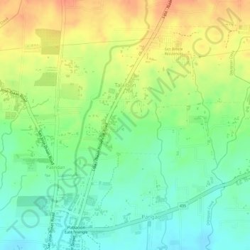
Name: Talaibon topographic map, elevation, terrain.
Location: Talaibon, Ibaan, Batangas, Calabarzon, 4230, Philippines (13.82254 121.13300 13.84416 121.15432)
Average elevation: 142 m
Minimum elevation: 118 m
Maximum elevation: 166 m
Thank you for supporting this site ❤️
Make a donation
Make a donation
Other topographic maps
Click on a map to view its topography, its elevation and its terrain.
Thank you for supporting this site ❤️
Make a donation
Make a donation
Thank you for supporting this site ❤️
Make a donation
Make a donation
Thank you for supporting this site ❤️
Make a donation
Make a donation
Thank you for supporting this site ❤️
Make a donation
Make a donation