
Grän topographic map
Interactive map
Click on the map to display elevation.
About this map
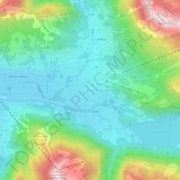
Name: Grän topographic map, elevation, terrain.
Location: Grän, Gemeinde Grän, Bezirk Reutte, Tirol, 6673, Oostenrijk (47.48101 10.53346 47.52101 10.57346)
Average elevation: 1,305 m
Minimum elevation: 1,095 m
Maximum elevation: 1,843 m