
Make a donation
Murray County topographic map
Click on the map to display elevation.
Make a donation
Murray County
The county terrain consists of low rolling hills, dotted with lakes and ponds, with all available area devoted to agriculture. The terrain slopes to the south and east. However, its highest elevation occurs on Buffalo Ridge, a promontory extending about two miles along the crest of the Coteau des Prairies in central Chanarambie Township. The bluff rises a few hundred feet above the adjacent valleys. The county has a total area of 720 square miles (1,900 km2), of which 705 square miles (1,830 km2) is land and 15 square miles (39 km2) (2.1%) is water.
Make a donation
About this map
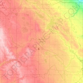
Name: Murray County topographic map, elevation, terrain.
Location: Murray County, Minnesota, United States (43.84900 -96.06532 44.19658 -95.46220)
Average elevation: 485 m
Minimum elevation: 357 m
Maximum elevation: 583 m
Make a donation
Other topographic maps
Click on a map to view its topography, its elevation and its terrain.
Minneapolis
United States > Minnesota > Hennepin County > Minneapolis
A 1959 report by the U.S. Soil Conservation Service listed Minneapolis's elevation as 830 feet (250 m). The city's lowest elevation of 687 feet (209 m) above sea level is near where Minnehaha Creek meets the Mississippi River. Sources disagree on the exact location and elevation of the city's highest point,…
Average elevation: 271 m
North Shore Mining/Lake Superior Overlook
United States > Minnesota > Lake County > Silver Bay
Average elevation: 252 m
Make a donation
Make a donation
Eagle Mountain
United States > Minnesota > Cook County
Eagle Mountain is only about 15 miles (24 km) from Minnesota's lowest elevation, Lake Superior, at 600 feet (183 m). It is part of the Canadian Shield. There is also another much shorter peak also named Eagle Mountain in northern Minnesota. The shorter peak is part of the Lutsen Mountains ski resort.
Average elevation: 596 m
Make a donation
Barnes Lake
United States > Minnesota > Carver County > Norwood Young America
Average elevation: 300 m
Make a donation
Make a donation
Make a donation
Make a donation
Make a donation
Make a donation
Make a donation
Make a donation
Maple Lake
United States > Minnesota > Wright County > Maple Lake > Maple Lake
Average elevation: 314 m
Make a donation
Make a donation
Fergus Falls
United States > Minnesota > Otter Tail County > Fergus Falls > Fergus Falls
Average elevation: 375 m
Make a donation
Make a donation
Silver Lake
United States > Minnesota > McLeod County > Silver Lake > Silver Lake
Average elevation: 320 m
Make a donation
Make a donation