
Thank you for supporting this site ❤️
Make a donation
Make a donation
Quay topographic map
Click on the map to display elevation.
Thank you for supporting this site ❤️
Make a donation
Make a donation
About this map
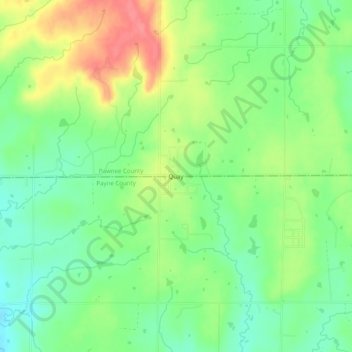
Name: Quay topographic map, elevation, terrain.
Location: Quay, Pawnee County, Oklahoma, United States (36.13951 -96.73086 36.17951 -96.69086)
Average elevation: 282 m
Minimum elevation: 252 m
Maximum elevation: 325 m
Thank you for supporting this site ❤️
Make a donation
Make a donation
Other topographic maps
Click on a map to view its topography, its elevation and its terrain.