
Hamburg-Mitte topographic map
Interactive map
Click on the map to display elevation.
About this map
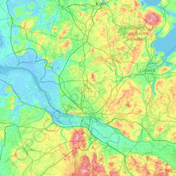
Name: Hamburg-Mitte topographic map, elevation, terrain.
Location: Hamburg-Mitte, Hamburg, Duitsland (53.45388 8.10450 54.02765 10.16878)
Average elevation: 26 m
Minimum elevation: -6 m
Maximum elevation: 157 m
Other topographic maps
Click on a map to view its topography, its elevation and its terrain.