
Adelboden topographic map
Interactive map
Click on the map to display elevation.
About this map
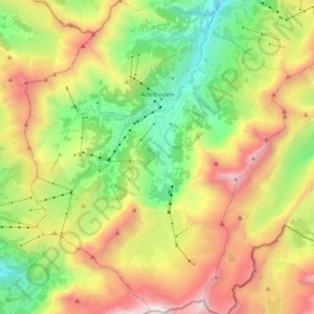
Name: Adelboden topographic map, elevation, terrain.
Average elevation: 1,962 m
Minimum elevation: 1,052 m
Maximum elevation: 3,233 m
Adelboden est un village de montagne situé dans la partie ouest de l’Oberland bernois, au fond de l’Engstligental, à quarante km au sud-est de Thoune. Le point culminant se trouve à 3 242 mètres d'altitude au Wildstrubel. Le point le plus bas est à 1 045 mètres.
Other topographic maps
Click on a map to view its topography, its elevation and its terrain.
Schönbühl
Suisse > Berne > Arrondissement administratif de Frutigen-Bas-Simmental > Adelboden
Schönbühl, Adelboden, Arrondissement administratif de Frutigen-Bas-Simmental, Région administrative de l'Oberland, Berne, 3715, Suisse
Average elevation: 1,445 m