Geolocate

Vaals topographic map

Interactive map

Click on the map to display elevation.

About this map

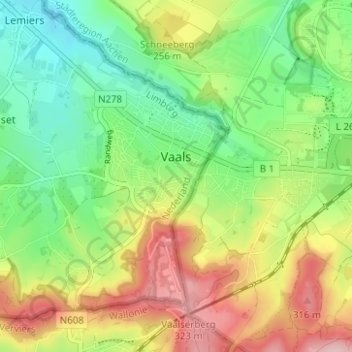
Name: Vaals topographic map, elevation, terrain.

Location: Vaals, Limburg, Netherlands (50.75276 5.96561 50.78499 6.02785)

Average elevation: 226 m

Minimum elevation: 145 m

Maximum elevation: 342 m

Other topographic maps

Click on a map to view its topography, its elevation and its terrain.

America

Netherlands > Limburg

America, Horst aan de Maas, Limburg, Netherlands

Average elevation: 31 m

Horst aan de Maas

Netherlands > Limburg

Horst aan de Maas, Limburg, Netherlands

Average elevation: 27 m