
Thank you for supporting this site ❤️
Make a donation
Make a donation
Skibbereen topographic map
Click on the map to display elevation.
Thank you for supporting this site ❤️
Make a donation
Make a donation
About this map
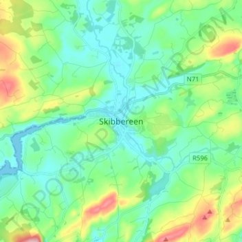
Name: Skibbereen topographic map, elevation, terrain.
Location: Skibbereen, West Cork, County Cork, Munster, P81 HH64, Ireland (51.51000 -9.30668 51.59000 -9.22668)
Average elevation: 48 m
Minimum elevation: -3 m
Maximum elevation: 184 m
Thank you for supporting this site ❤️
Make a donation
Make a donation