
Thank you for supporting this site ❤️
Make a donation
Make a donation
Hua Dong topographic map
Click on the map to display elevation.
Thank you for supporting this site ❤️
Make a donation
Make a donation
About this map
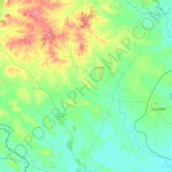
Name: Hua Dong topographic map, elevation, terrain.
Location: Hua Dong, Maha Sarakham Province, 44180, Thailand (15.51812 103.04110 15.83812 103.36110)
Average elevation: 154 m
Minimum elevation: 131 m
Maximum elevation: 212 m
Thank you for supporting this site ❤️
Make a donation
Make a donation