
Thank you for supporting this site ❤️
Make a donation
Make a donation
Vik topographic map
Click on the map to display elevation.
Thank you for supporting this site ❤️
Make a donation
Make a donation
About this map
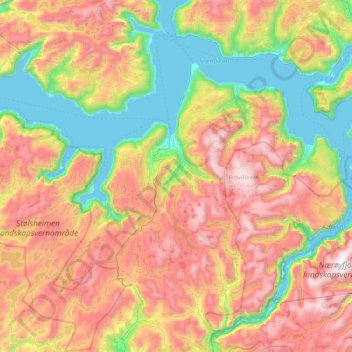
Name: Vik topographic map, elevation, terrain.
Location: Vik, Vestland, Norway (60.88073 6.13581 61.19071 7.03008)
Average elevation: 739 m
Minimum elevation: 0 m
Maximum elevation: 1,761 m
Thank you for supporting this site ❤️
Make a donation
Make a donation
Other topographic maps
Click on a map to view its topography, its elevation and its terrain.