
Thank you for supporting this site ❤️
Make a donation
Make a donation
Dunkerton topographic map
Click on the map to display elevation.
Thank you for supporting this site ❤️
Make a donation
Make a donation
About this map
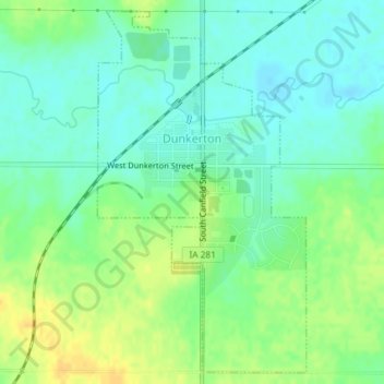
Name: Dunkerton topographic map, elevation, terrain.
Location: Dunkerton, Black Hawk County, Iowa, 50626, United States (42.55539 -92.17081 42.58080 -92.15087)
Average elevation: 296 m
Minimum elevation: 285 m
Maximum elevation: 312 m
Thank you for supporting this site ❤️
Make a donation
Make a donation
Other topographic maps
Click on a map to view its topography, its elevation and its terrain.