
Jepara topographic map
Interactive map
Click on the map to display elevation.
About this map
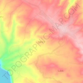
Name: Jepara topographic map, elevation, terrain.
Location: Jepara, Ogan Komering Ulu Selatan, Süd-Sumatra, Indonesien (-4.83492 103.98072 -4.79492 104.02072)
Average elevation: 677 m
Minimum elevation: 538 m
Maximum elevation: 741 m