
Thank you for supporting this site ❤️
Make a donation
Make a donation
Orangeville topographic map
Click on the map to display elevation.
Thank you for supporting this site ❤️
Make a donation
Make a donation
About this map
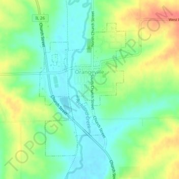
Name: Orangeville topographic map, elevation, terrain.
Location: Orangeville, Stephenson County, Illinois, United States (42.45529 -89.65516 42.47537 -89.63748)
Average elevation: 261 m
Minimum elevation: 239 m
Maximum elevation: 296 m
Thank you for supporting this site ❤️
Make a donation
Make a donation