
Thank you for supporting this site ❤️
Make a donation
Make a donation
Lamhako topographic map
Click on the map to display elevation.
Thank you for supporting this site ❤️
Make a donation
Make a donation
About this map
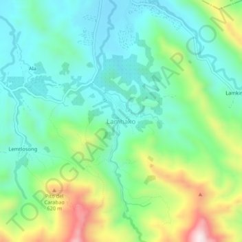
Name: Lamhako topographic map, elevation, terrain.
Location: Lamhako, T'Boli, South Cotabato, Soccsksargen, Philippines (6.24416 124.84387 6.28416 124.88387)
Average elevation: 411 m
Minimum elevation: 253 m
Maximum elevation: 788 m
Thank you for supporting this site ❤️
Make a donation
Make a donation
Other topographic maps
Click on a map to view its topography, its elevation and its terrain.