
Thank you for supporting this site ❤️
Make a donation
Make a donation
Isla topographic map
Click on the map to display elevation.
Thank you for supporting this site ❤️
Make a donation
Make a donation
About this map
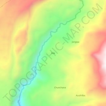
Name: Isla topographic map, elevation, terrain.
Location: Isla, Oyolo, Páucar del Sara Sara, Ayacucho, Perú (-15.15325 -73.19341 -15.11325 -73.15341)
Average elevation: 3,889 m
Minimum elevation: 3,440 m
Maximum elevation: 4,375 m
Thank you for supporting this site ❤️
Make a donation
Make a donation