
Saint-Daniel topographic map
Interactive map
Click on the map to display elevation.
About this map
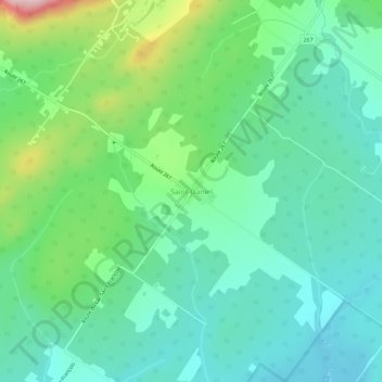
Name: Saint-Daniel topographic map, elevation, terrain.
Average elevation: 361 m
Minimum elevation: 290 m
Maximum elevation: 559 m
Other topographic maps
Click on a map to view its topography, its elevation and its terrain.
Lac du Huit
Canada > Québec > Les Appalaches > Adstock > Sainte-Anne-du-Lac
Lac du Huit, Sainte-Anne-du-Lac, Adstock, Les Appalaches, Chaudière-Appalaches, Québec, Canada
Average elevation: 401 m