
Valleyre topographic map
Interactive map
Click on the map to display elevation.
About this map
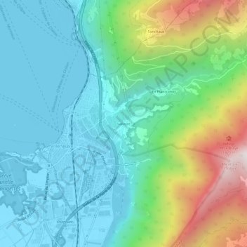
Name: Valleyre topographic map, elevation, terrain.
Location: Valleyre, Villeneuve (VD), District d'Aigle, Vaud, 1844, Suisse (46.38020 6.91936 46.42020 6.95936)
Average elevation: 729 m
Minimum elevation: 370 m
Maximum elevation: 1,785 m